Movement of Over Dimensional Cargo (ODC) from Nearest National Highway Corridors to Mumbai Port – Route Feasibility, Infrastructure Constraints & Logistics Assessment

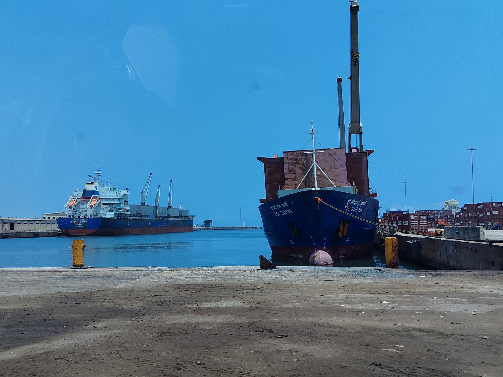
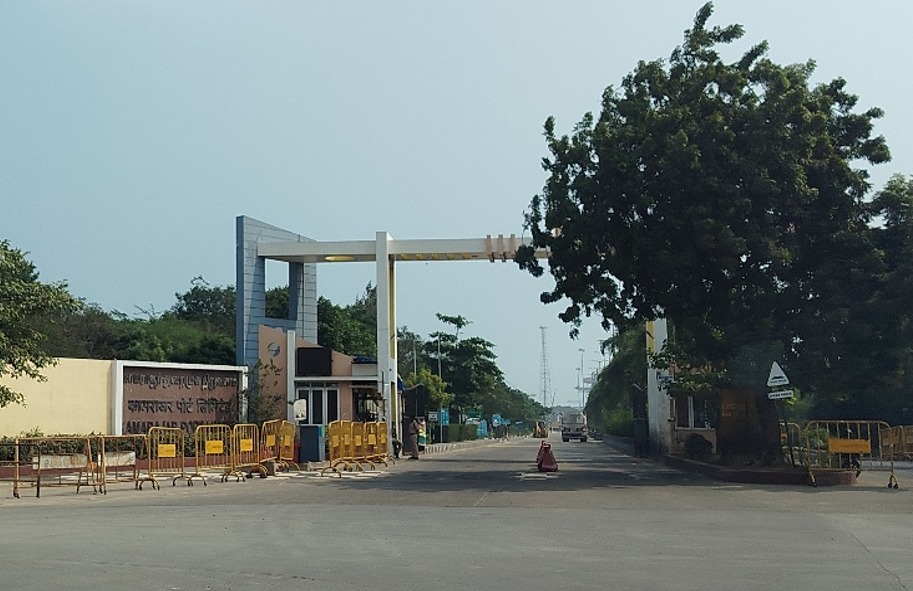
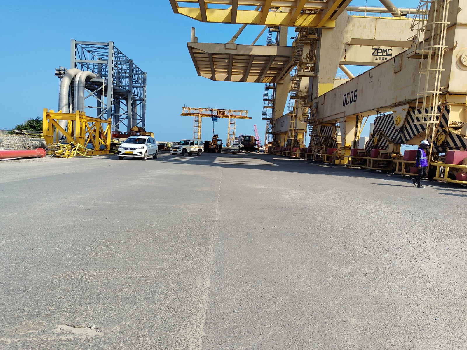
Assess the feasibility of transporting Over Dimensional Cargo, oversized industrial equipment and heavy project cargo from major National Highway corridors to Mumbai Port. This specialized engineering and logistics study evaluates highway-to-port connectivity, NH-48 access, Eastern Mumbai road approaches, road geometry, bridge and flyover constraints, railway overbridges, junction maneuverability, overhead utilities, multi-axle trailer requirements, urban traffic conditions and port access infrastructure to support safer and more efficient heavy haulage operations.

📄
Format
PDF
📋
Pages
100
◉
Geography
India
◔
Forecast
-
▣
Publisher
RACE Innovations
OPEN IN AI
Reading time: 6 min

Key Highlights

⊚
National Highway-to-Mumbai Port ODC route feasibility assessment
⊚
NH-48 regional connectivity assessment
⊚
Eastern Express Highway corridor evaluation
⊚
Eastern Freeway connectivity interface assessment
⊚
Sion–Panvel and Mumbai–Pune connectivity review
⊚
NH-66 regional connectivity assessment
⊚
BPT Road and Orange Gate access assessment
⊚
Indira Dock approach route evaluation
⊚
Wadala–Sewri logistics corridor assessment
⊚
Alternative ODC route identification and comparison
⊚
Highway-to-port route suitability analysis
⊚
Road width and carriageway assessment
⊚
Road shoulder and pavement condition assessment
⊚
Urban road geometry assessment
⊚
Junction and intersection maneuverability analysis
⊚
Heavy trailer turning radius assessment
⊚
Swept-path and maneuverability considerations
⊚
Bridge and culvert constraint identification
⊚
Bridge load suitability considerations
⊚
Flyover and elevated road clearance assessment
⊚
Railway overbridge constraint assessment
⊚
Underpass clearance assessment
⊚
Vertical and horizontal clearance assessment
⊚
Overhead power line and utility assessment
⊚
Traffic signal and gantry constraint assessment
⊚
Metro and railway infrastructure interface assessment
⊚
Road median and traffic island assessment
⊚
Multi-axle trailer movement feasibility
⊚
Hydraulic modular trailer suitability assessment
⊚
SPMT movement considerations
⊚
Urban traffic congestion and bottleneck assessment
⊚
Heavy commercial traffic interface assessment
⊚
Port approach road assessment
⊚
Port gate and cargo-entry movement assessment
⊚
Internal port road movement considerations
⊚
Atal Setu connectivity interface review
⊚
Temporary infrastructure modification requirements
⊚
Utility lifting and shifting requirements
⊚
ODC escort and traffic management planning
⊚
Police and regulatory permission considerations
⊚
Critical route hotspot identification
⊚
Route risk matrix and mitigation strategy
⊚
Heavy haulage movement recommendations

Why This Report Matters

This report supports project owners, EPC contractors, heavy engineering manufacturers, ODC transporters, freight forwarders and project logistics companies in evaluating National Highway-to-Mumbai Port movement options before cargo mobilization. The study identifies critical infrastructure constraints and logistics bottlenecks, compares potential access corridors, evaluates multi-axle trailer maneuverability and highlights locations that may require detailed engineering verification, traffic diversion, temporary road modification, utility intervention or coordination with road, traffic, railway, municipal and port authorities.
What's Inside the Report

01Executive Summary
02Study Objectives and Scope
03ODC Transportation Overview
04Project Cargo and Heavy Haulage Overview
05Mumbai Port Authority Overview
06Mumbai Port Cargo and Logistics Infrastructure
07Mumbai Port Road Connectivity Overview
08National Highway Network Serving Mumbai Port
09NH-48 Regional Connectivity Assessment
10Eastern Express Highway Corridor Assessment
11Eastern Freeway Connectivity Assessment
12Sion–Panvel Corridor Interface
13Mumbai–Pune Expressway Connectivity Interface
14NH-66 Regional Connectivity Assessment
15BPT Road Assessment
16Orange Gate Connectivity Assessment
17Indira Dock Approach Assessment
18Wadala–Sewri Corridor Assessment
19Atal Setu / MTHL Connectivity Interface
20Potential ODC Route Options
21Route Selection Methodology
22Route Comparison Framework
23ODC Cargo Dimension and Weight Considerations
24Trailer Configuration Assessment
25Multi-Axle Trailer Suitability
26Hydraulic Modular Trailer Assessment
27SPMT Movement Considerations
28Road Geometry Assessment
29Road Width and Carriageway Assessment
30Road Shoulder Assessment
31Pavement Condition Assessment
32Horizontal Alignment and Curve Assessment
33Junction and Intersection Assessment
34Turning Radius Assessment
35Swept Path Assessment
36Bridge Infrastructure Assessment
37Bridge Load Considerations
38Culvert Assessment
39Flyover and Elevated Road Assessment
40Railway Overbridge Assessment
41Underpass Clearance Assessment
42Vertical Clearance Assessment
43Horizontal Clearance Assessment
44Overhead Electrical Line Assessment
45Utility Crossing Assessment
46Traffic Signal Assessment
47Gantries and Sign Structure Constraints
48Metro Infrastructure Interface Assessment
49Railway Infrastructure Interface Assessment
50Road Median and Traffic Island Constraints
51Street Furniture and Roadside Obstructions
52Dense Urban Area Constraint Assessment
53Industrial Area Traffic Assessment
54Traffic Congestion Assessment
55Construction Zone Assessment
56Mumbai Port Approach Road Assessment
57Port Gate and Security Access Assessment
58Internal Port Road Assessment
59Dock and Terminal Access Considerations
60Alternative Route Assessment
61Route Comparison Matrix
62Critical Constraint Locations
63Temporary Civil Work Requirements
64Road and Shoulder Modification Requirements
65Median and Traffic Island Modification Requirements
66Utility Lifting and Shifting Requirements
67Traffic Diversion Requirements
68ODC Escort Requirements
69Mumbai Traffic Police Coordination
70Municipal Authority Coordination
71National Highway Permission Requirements
72Port Authority Coordination Requirements
73Railway and Utility Agency Coordination
74Movement Timing and Scheduling
75Night Movement Considerations
76Safety and Emergency Planning
77Operational Risk Assessment
78Route Risk Matrix
79Risk Mitigation Measures
80Indicative Heavy Haulage Strategy
81Indicative ODC Movement Plan
82Key Findings and Recommendations
83Route Maps and Location References
84Constraint Register
85Route Photographs
86Infrastructure Annexure

Who Should Buy This Report

◌
Executive Summary
◌
Study Objectives and Scope
◌
ODC Transportation Overview
◌
Project Cargo and Heavy Haulage Overview
◌
Mumbai Port Authority Overview
◌
Mumbai Port Cargo and Logistics Infrastructure
◌
Mumbai Port Road Connectivity Overview
◌
National Highway Network Serving Mumbai Port
◌
NH-48 Regional Connectivity Assessment
◌
Eastern Express Highway Corridor Assessment
◌
Eastern Freeway Connectivity Assessment
◌
Sion–Panvel Corridor Interface
◌
Mumbai–Pune Expressway Connectivity Interface
◌
NH-66 Regional Connectivity Assessment
◌
BPT Road Assessment
◌
Orange Gate Connectivity Assessment
◌
Indira Dock Approach Assessment
◌
Wadala–Sewri Corridor Assessment
◌
Atal Setu / MTHL Connectivity Interface
◌
Potential ODC Route Options
◌
Route Selection Methodology
◌
Route Comparison Framework
◌
ODC Cargo Dimension and Weight Considerations
◌
Trailer Configuration Assessment
◌
Multi-Axle Trailer Suitability
◌
Hydraulic Modular Trailer Assessment
◌
SPMT Movement Considerations
◌
Road Geometry Assessment
◌
Road Width and Carriageway Assessment
◌
Road Shoulder Assessment
◌
Pavement Condition Assessment
◌
Horizontal Alignment and Curve Assessment
◌
Junction and Intersection Assessment
◌
Turning Radius Assessment
◌
Swept Path Assessment
◌
Bridge Infrastructure Assessment
◌
Bridge Load Considerations
◌
Culvert Assessment
◌
Flyover and Elevated Road Assessment
◌
Railway Overbridge Assessment
◌
Underpass Clearance Assessment
◌
Vertical Clearance Assessment
◌
Horizontal Clearance Assessment
◌
Overhead Electrical Line Assessment
◌
Utility Crossing Assessment
◌
Traffic Signal Assessment
◌
Gantries and Sign Structure Constraints
◌
Metro Infrastructure Interface Assessment
◌
Railway Infrastructure Interface Assessment
◌
Road Median and Traffic Island Constraints
◌
Street Furniture and Roadside Obstructions
◌
Dense Urban Area Constraint Assessment
◌
Industrial Area Traffic Assessment
◌
Traffic Congestion Assessment
◌
Construction Zone Assessment
◌
Mumbai Port Approach Road Assessment
◌
Port Gate and Security Access Assessment
◌
Internal Port Road Assessment
◌
Dock and Terminal Access Considerations
◌
Alternative Route Assessment
◌
Route Comparison Matrix
◌
Critical Constraint Locations
◌
Temporary Civil Work Requirements
◌
Road and Shoulder Modification Requirements
◌
Median and Traffic Island Modification Requirements
◌
Utility Lifting and Shifting Requirements
◌
Traffic Diversion Requirements
◌
ODC Escort Requirements
◌
Mumbai Traffic Police Coordination
◌
Municipal Authority Coordination
◌
National Highway Permission Requirements
◌
Port Authority Coordination Requirements
◌
Railway and Utility Agency Coordination
◌
Movement Timing and Scheduling
◌
Night Movement Considerations
◌
Safety and Emergency Planning
◌
Operational Risk Assessment
◌
Route Risk Matrix
◌
Risk Mitigation Measures
◌
Indicative Heavy Haulage Strategy
◌
Indicative ODC Movement Plan
◌
Key Findings and Recommendations
◌
Route Maps and Location References
◌
Constraint Register
◌
Route Photographs
◌
Infrastructure Annexure

Report Deliverables

⇩
PDF Report
100-page comprehensive analysis
◎
Market Forecast
Forward-looking projections and trend outlook
✦
Analyst Access
30-minute post-purchase consultation
◔
Update Access
12-month access to interim updates

Frequently Asked Questions

What format will I receive the report in?
The report is delivered in PDF format only.
Can I request a customized version of this report?
Yes. We can tailor the report scope, segment coverage, OEM coverage, forecast horizon, and output structure based on your requirements.
Is a sample available before purchase?
Yes. A sample preview or selected extract can be shared for review before final purchase confirmation.
What license options are available?
We offer single-user, team, and enterprise licensing options depending on your organization size and usage requirements.
How frequently is the report updated?
This report includes the current edition and can also be supported with periodic updates depending on the subscription or engagement structure.

Tags

OVER DIMENSIONAL CARGOODC TRANSPORTATIONODC LOGISTICSODC ROUTE SURVEYODC ROUTE FEASIBILITYODC ROUTE ASSESSMENTODC TRANSPORT INDIAOVERSIZED CARGO TRANSPORTOVERSIZE LOAD TRANSPORTPROJECT CARGOPROJECT CARGO LOGISTICSPROJECT CARGO TRANSPORTATIONHEAVY HAULAGEHEAVY HAULAGE INDIAHEAVY CARGO TRANSPORTHEAVY LIFT LOGISTICSHEAVY EQUIPMENT TRANSPORTMUMBAI PORTMUMBAI PORT AUTHORITYMUMBAI PORT LOGISTICSMUMBAI PORT CONNECTIVITYMUMBAI PORT ODCMBPAMUMBAI PORT TRUSTMUMBAI LOGISTICSMUMBAI PROJECT CARGOMAHARASHTRA LOGISTICSMAHARASHTRA PORT LOGISTICSNH48NH 48NH48 MUMBAINATIONAL HIGHWAY MUMBAIEASTERN EXPRESS HIGHWAYEASTERN FREEWAYSION PANVEL HIGHWAYMUMBAI PUNE EXPRESSWAYNH66NH 66ATAL SETUMUMBAI TRANS HARBOUR LINKMTHLBPT ROADINDIRA DOCKORANGE GATE MUMBAI PORTSEWRIWADALAHIGHWAY TO PORT CONNECTIVITYNATIONAL HIGHWAY LOGISTICSPORT CONNECTIVITYPORT LOGISTICSPORT INFRASTRUCTUREPORT ACCESS ROADODC PORT CONNECTIVITYROUTE FEASIBILITY STUDYHEAVY HAUL ROUTE SURVEYROAD ROUTE SURVEYROAD INFRASTRUCTURE ASSESSMENTINFRASTRUCTURE CONSTRAINTSURBAN ODC TRANSPORTATIONBRIDGE CLEARANCEBRIDGE LOAD CAPACITYFLYOVER CLEARANCERAILWAY OVERBRIDGE CLEARANCEUNDERPASS CLEARANCEVERTICAL CLEARANCEHORIZONTAL CLEARANCEOVERHEAD UTILITY CLEARANCEUTILITY SHIFTINGMULTI AXLE TRAILERHYDRAULIC MODULAR TRAILERSPMT TRANSPORTSPECIALIZED TRANSPORTATIONINDUSTRIAL LOGISTICSPROJECT LOGISTICS INDIACARGO ROUTE PLANNINGLOGISTICS RISK ASSESSMENTHEAVY TRANSPORT ENGINEERINGPORT ROAD FEASIBILITYODC CLEARANCE SURVEYHEAVY EQUIPMENT LOGISTICSHEAVY TRANSPORT MUMBAI
Movement of Over Dimensional Cargo (ODC) from Nearest National Highway Corridors to Mumbai Port – Route Feasibility, Infrastructure Constraints & Logistics Assessment

Movement of Over Dimensional Cargo (ODC) from Nearest National Highway Corridors to Mumbai Port – Route Feasibility, Infrastructure Constraints & Logistics Assessment

To be Requested
FormatPDF
LicenseSingle User
Delivery1 - 2 Weeks
Need help choosing the right report?

Our market intelligence experts can help you identify the most relevant data, forecasts, and insights for your business needs.

  • ✓One-to-One Expert Consultation
  • ✓Custom Research Guidance
  • ✓Report Demonstration
  • ✓Enterprise Pricing & Licensing

Related Reports

See all →